“Map of the Central Business District of Boston” print by Geo. W. Stadly & Co. (1896)
“Map of the Central Business District of Boston” print by Geo. W. Stadly & Co. (1896)
Couldn't load pickup availability
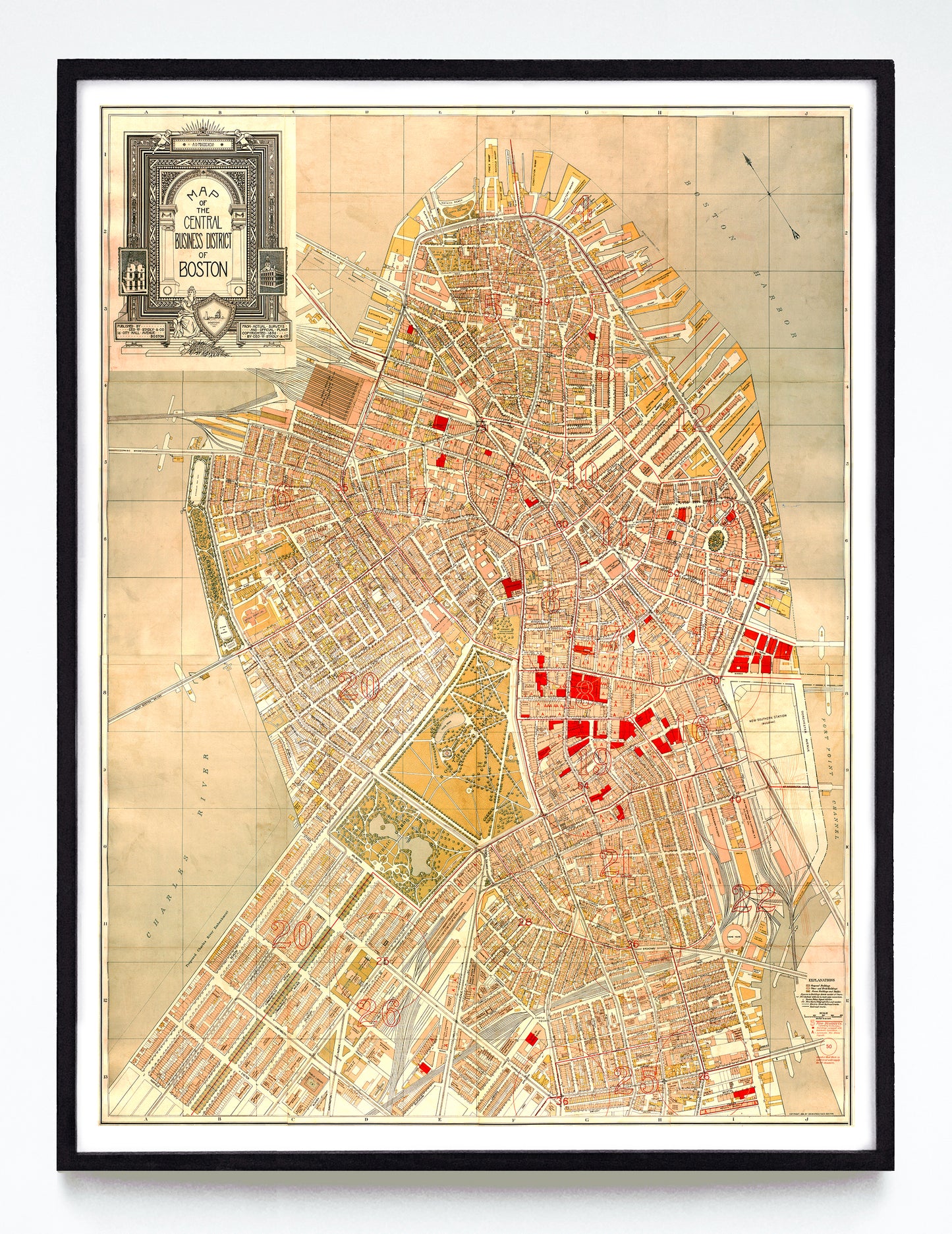
On one hand, this map is a mess, and I've done my best to clean it up. Its neatline (ie. its outermost border) was more warbled than neat, the map itself was split into two pieces, and I don't think there's such thing as getting it flat again. On the other hand, it is opulent in its detailing and the title plate at top left is gorgeous. For all its deficiencies, it's still a special map.
Of note: the large red outlined numbers indicate fire districts, the smaller numbers in circles "denote that there is sufficient water supply" for that number of fire department crews, and the buildings drawn in red ink are equipped with automatic sprinklers. The 1872 fire clearly still loomed large.
Available as a reproduction at 12x16" or 18x24" on Epson Enhanced Matte 192 gsm paper printed with Epson UltraChrome XD2 archival ink. Sold in an open edition, unframed. Based on this public domain image held by the Norman B. Leventhal Map & Education Center.