“Boston (Massachusetts) & Vicinity” print by Ernest Dudley Chase (1938)
“Boston (Massachusetts) & Vicinity” print by Ernest Dudley Chase (1938)
Couldn't load pickup availability
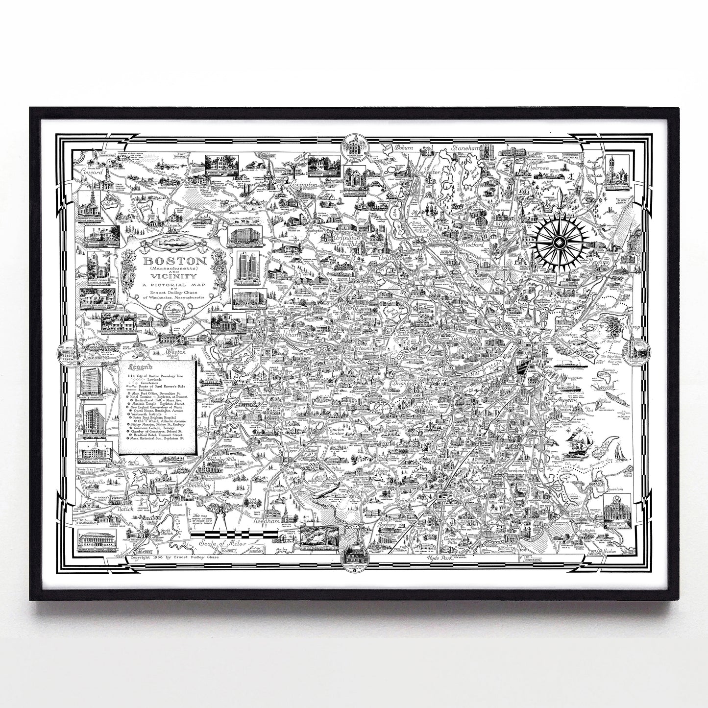
If pictorial map makers were household names in America, Ernest Dudley Chase would be among the most famous of them all. In the first half of the 20th century his incredibly detailed world, continental, and national maps sprung to life from his Winchester, MA, home, and a few wonderful examples still exist today.
Here I'm showing you what it looks like when Dudley pointed his skilled eye at Boston and surrounding areas. Hundreds of tiny vignettes decorate the sheet, showing everything from Weston in the west to Governor's Island in the east, just below the giant head blowing the "east wind" at Logan Airport.
Chase printed a few different coloured versions of this image over the years, but I'm presenting the B&W version—I find that with colour in the mix, the image becomes an almost overwhelming mess of details. And while you could order this at 16x12", I highly recommend splurging on the larger size. You're going to get lost in this thing.
Available as a reproduction at 16x12" or 24x18" on Epson Enhanced Matte 192 gsm paper printed with Epson UltraChrome XD2 archival ink. Sold in an open edition, unframed. Based on this public domain image held by the Norman B. Leventhal Map & Education Center.