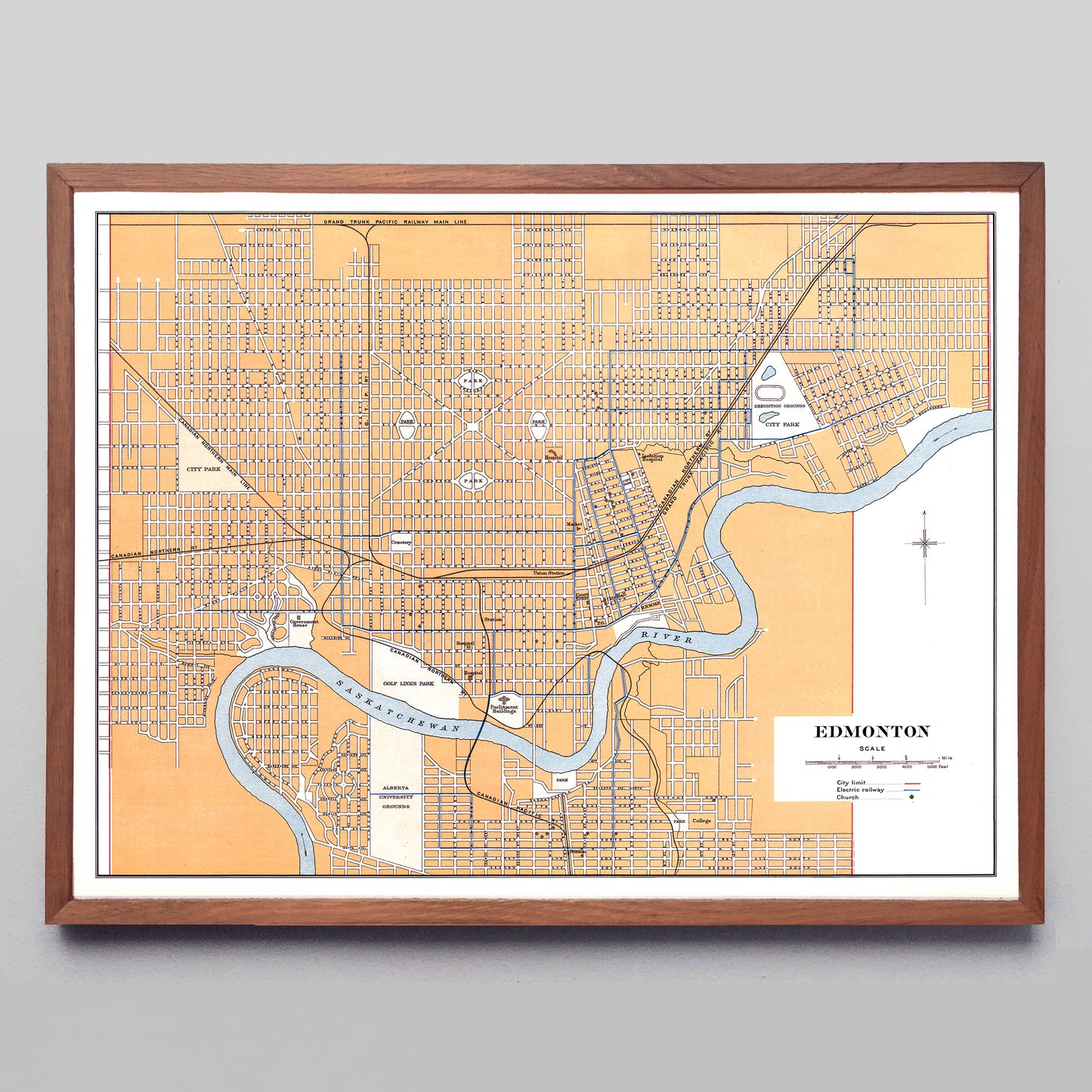
"Edmonton" print by the Canadian Department of the Interior (1915)
"Edmonton" print by the Canadian Department of the Interior (1915)
Couldn't load pickup availability
Take a look at where the modern-day Hawrelak Park and Royal Mayfair Golf Club should be on this map, and instead of trees and green you'll find a neighbourhood full of names like “Imperial Ave.” and “Seamore Ave.”
What’s going on there? Well, the mapmakers thought they’d include this planned and approved neighbourhood (Mayfair Park) in their 1915 Atlas of Canada, and sent the book off to press. Shortly afterward, the 1915 North Saskatchewan Flood submerged the area, its developers (the Strathcona Land Syndicate) got cold feet, by 1922 they gave the land to the city to avoid paying taxes on it, and by 1955 the area would start to look a little like it looks today.
A reproduction available at 16x12" or 24x18" on Epson Enhanced Matte 192 gsm paper printed with Epson UltraChrome XD2 archival ink. Sold in an open edition, unframed. Based on a public domain image found in the 1915 Atlas of Canada.


