
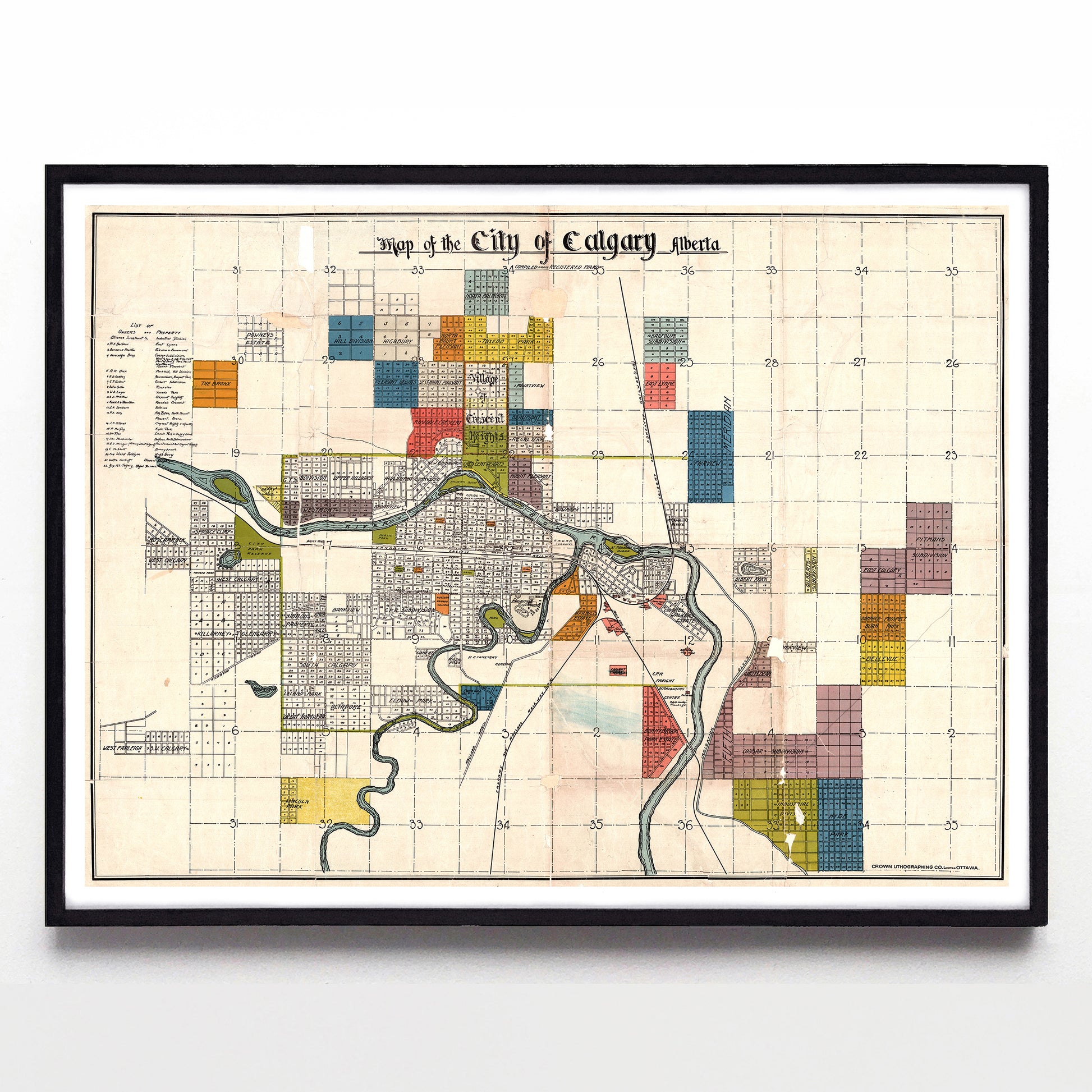
“Map of the City of Calgary Alberta Compiled from Registered Plans” by the Crown Lithograph Co. (1908)
“Map of the City of Calgary Alberta Compiled from Registered Plans” by the Crown Lithograph Co. (1908)
Couldn't load pickup availability
This joyful little map comes to us from 1908, when the Ottawa based Crown Lithographing Co. put together dozens of neighbourhood street plans into a single colour-coded scheme. I've pepped up the colours slightly, but the most charming thing on it is the inclusion of the "Happyland" neighbourhood in yellow just west of modern Hillhurst - whoever tossed that name in the dustbin of history should be jailed.
I'm also a fan of the blackletter title and how clearly it tracks the original lakes and shores of Calgary. Anyone remember the Albert Park and Currie lakes, or when the Shaganappi Point Golf Course was a public park reserve on the Bow?
A reproduction available at 16x12" or 24x18" on Epson Enhanced Matte 192 gsm paper printed with Epson UltraChrome XD2 archival ink. Sold in an open edition, unframed. Based on this original public domain image held by the Historical Maps Collection at the University of Calgary Libraries & Cultural Resources Digital Collection.
