“Plan of the Towns of Windsor, Walkerville and Sandwich” print by G. McPhillips (1890)
“Plan of the Towns of Windsor, Walkerville and Sandwich” print by G. McPhillips (1890)
Couldn't load pickup availability
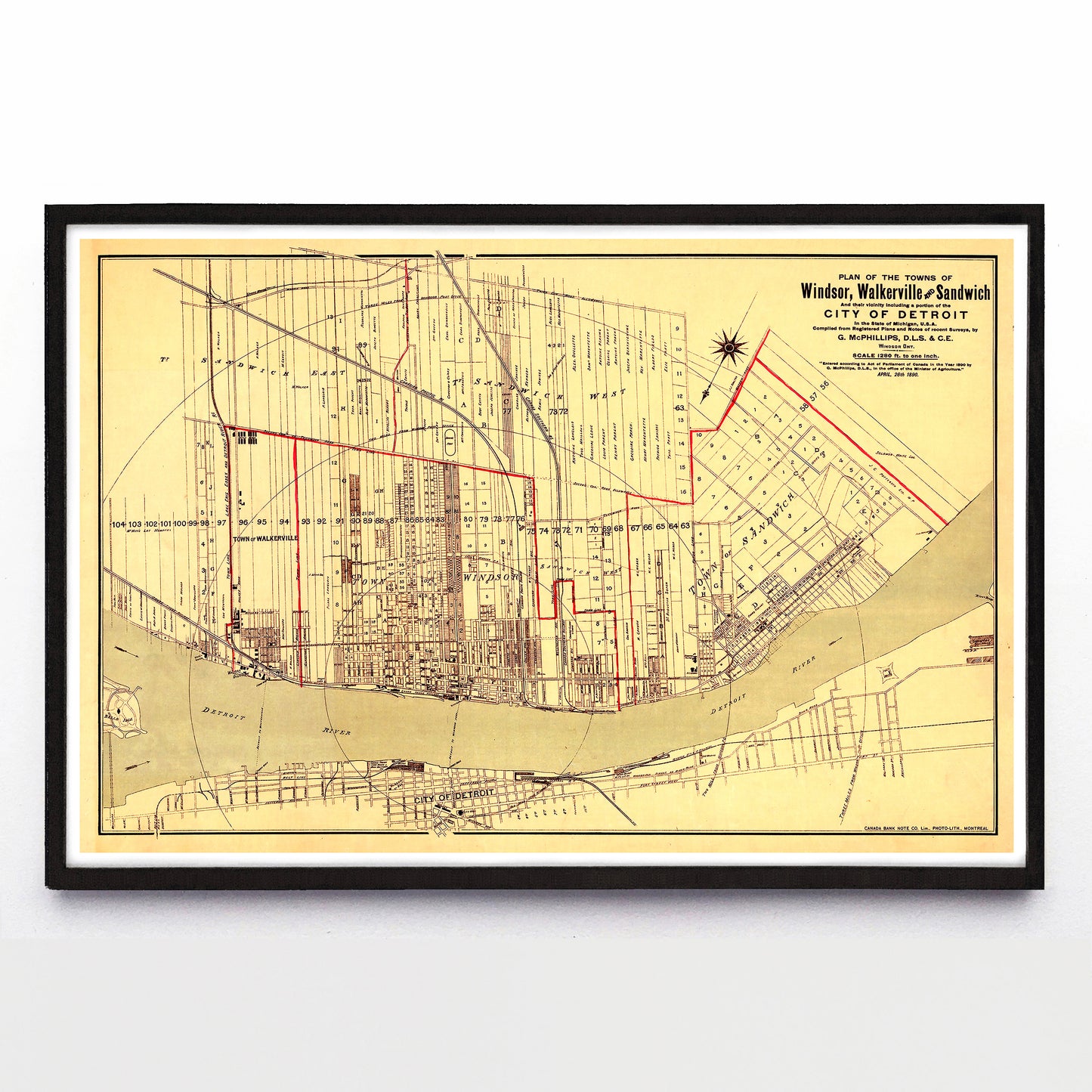
Mark Monmonier’s 1991 book How to Lie With Maps argues that all maps direct the viewer towards a specific narrative, and that “a good map tells a multitude of little white lies” on the way to telling that narrative. If that’s the case, G. McPhillips’ 1890 map of the southwestern Ontario towns of Windsor, Walkerville and Sandwich strides towards greatness.
It correctly shows Windsor and the two towns it would amalgamate with in 1930, though at one point this map’s owner emphasized their boundaries with a thick red pen. City blocks and fields are long and thin with a small Detroit River frontage, a hand-me-down from the way French Canadian settlers divided North American land in the 1700s. Concentric circles also measure the distance from Windsor’s old central post office at the intersection of Ouellette Avenue and Pitt Street. These are factual. Its most obvious lie is that McPhillips has turned the earth completely around, putting Windsor above Detroit instead of following centuries north-is-up mapmaking convention.
Its second lie? How the map fades Detroit out, ending its street grid just beyond the waterfront. It’s drawn as if the 15th largest American city was just an orbiting berg of Windsor-Walkerville-Sandwich. Some towns want to be seen as on top of their rivals, and some want to be seen as the centre of the world. Here, a McPhillips pretended Windsor was both.
A reproduction available at 18x12” or 36x24” on Epson Enhanced Matte 192 gsm paper printed with Epson UltraChrome XD2 archival ink. Sold in an open edition, unframed. Based on this original public domain image held by Library & Archives Canada.