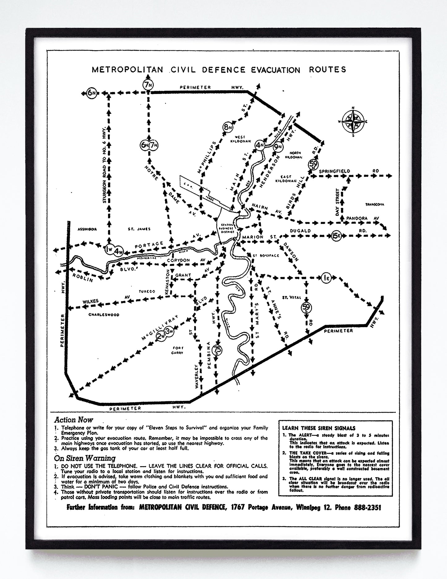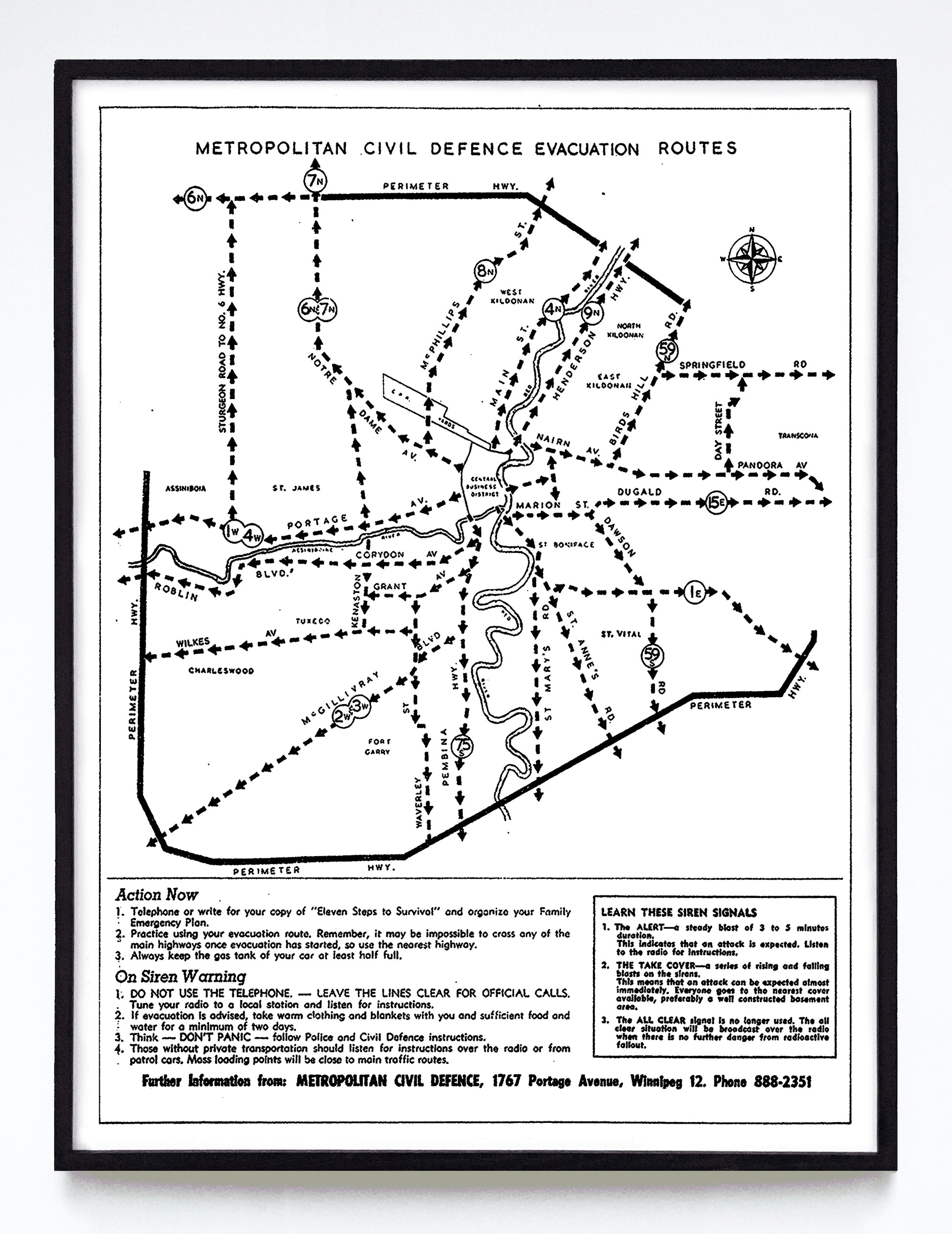
"(Winnipeg) Metropolitan Civil Defence Evacuation Routes" print (1964)
"(Winnipeg) Metropolitan Civil Defence Evacuation Routes" print (1964)
Couldn't load pickup availability
If you've read Andrew Burtch's excellent Give Me Shelter: the Failure of of Canada's Cold War Civil Defence (grab a copy right here) you know that Canadian civil defence was a bit of a hot potato, tossed between local, provincial and federal authorities who never really cooked anything with it. That means I don't know who, exactly, funded this Winnipeg evacuation map, but thanks to it I can tell you the correct route from your Grant Avenue apartment to the relative safety west of the ring road. It's up to you to drive it in five minutes, though. Good luck!
You would've found the original of this inserted in the 1964 Manitoba Telephone Service phone book, backed by another page of nuclear defence tips. Of note: this image is definitely not cleanly printed—it has craggy lines and irregular lettering, both of which I find charming but you might not.
A booklet cover reproduction available at 12x16" or 18x24" on Epson Enhanced Matte 192 gsm paper printed with Epson UltraChrome XD2 archival ink. Sold in an open edition, unframed.